
TopRox Project solutions
GIS, business and IT, from strategic plan to map.
Strategic planning and business strategy, operating procedures and IT data governance, plus GIS applications for utilities and power networks, the environment and cemeteries. We start from the data your organisation already has and turn it into prioritised decisions.
On this page
Utilities
For distribution system operators, grid owners and grid-connected solar parks. Analyses and tools built on data the operator already collects, with no new equipment, and results the technical team can use straight away.
- GIS data governance
- Momentary power interruptions
- Voltage monitoring
- Equipment inventory
- Equipment inspection
Cemetery digitisation with GIS
We draw every grave plot on aerial imagery, take over the existing register and install Locus on the computer of the town hall or parish. The data stays with the institution, with no map subscription. The register shows alerts for expiring concessions and overdue payments and automatically applies the 7-year term set by Romanian Law 102/2014.
GIS for the environment
Terrain, water and climate analysed on the map: from landforms to the hazards that threaten settlements and infrastructure. The analyses draw on the founder’s expertise in geomorphology.
- EGIE – climate adaptation
- Geomorphological analysis
- Floods
- Landslides
GIS service maintenance
A GIS stays useful only if its data, servers and applications are maintained. We take on this work, fully or in part, under contract.
- updating and correcting GIS data, using quality rules agreed with you;
- administering spatial servers and databases (QGIS Server, ArcGIS, PostGIS);
- updates, backups and monitoring of map services;
- user support and training as needed;
- a monthly report on activity and data condition.
Deliverablemaintenance contract with service levels (SLA) + monthly report.
Business
Experience from projects and organisations in the US and the European Union, applied to planning and running your business.
Project management
Projects delivered on time, on budget and with scope under control.
- the “Elite Project Management” course;
- project management courses for founders and managers;
- advice on starting and planning projects;
- risk, stakeholder and scope management;
- negotiation for Project Managers.
Strategic plans
A plan that shows why the business is stuck and what has to change for it to grow, scale or go digital.
- analysis of the current situation and growth blockers;
- a strategic and digital transformation plan, with priorities and deadlines;
- periodic review of the plan, on a subscription basis;
- on-site support in Sibiu and the surrounding area.
Our clients doubled their turnover in 2026 and credit the strategic plan for this result, in a year of crisis in their sector.
Operating procedures
Business and IT operating procedures: who does what, and in what order.
- mapping current processes and bottlenecks;
- written procedures for business and IT activities;
- roles, responsibilities and approval flows;
- team training and periodic review of the procedures.
IT data governance
Clear rules on who owns the data, who changes it and how it is protected.
- an inventory of data and responsibilities;
- policies for data quality, access and retention;
- GDPR compliance, with an audit using the GDPR_TopRox application;
- a roadmap for improvement.
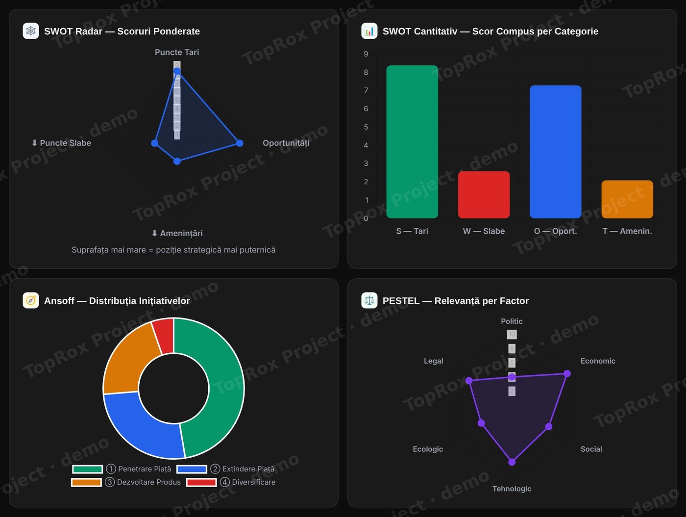 Open the full-size image (opens in a new tab)
In other fields too
Beyond the solutions above, we work wherever data has a place on the map: from adapting cities to the climate to transport and urban planning.
Climate adaptation
Where heat, floods and drought hit, who is most exposed and where the first measures matter most.
- urban heat islands, from land surface temperature measured by satellite;
- areas exposed to floods, landslides and drought;
- vulnerability maps: population, buildings and critical infrastructure;
- prioritising green spaces and the measures in adaptation plans.
Urban mobility
How people move around the city and what is missing from the network, for transport decisions backed by data.
- public transport accessibility: walking distance to the nearest stop for every neighbourhood;
- the cycle lane and pedestrian network, with its gaps;
- accident hotspots and heavy-traffic areas;
- analyses and maps for Sustainable Urban Mobility Plans (SUMP).
And in other fields:
- Public administration and urban planning
- Utilities: water, gas, energy
- Agriculture and forestry
- Transport and logistics
- Real estate and land registry
- Construction and infrastructure
- Tourism and heritage
How we can help
- auditing and structuring spatial databases;
- setting up a GIS in your organisation, with QGIS or ArcGIS;
- maps, spatial analysis and modelling on your own data;
- training your in-house team on its real projects.
How we start
You tell us what data you have and what decision you need to make. We propose a pilot project with objectives, deliverables and a deadline agreed in writing.
Discuss your projectLet’s talk about your data.
Tell us which grid, area or cemetery you would like us to assess and we will propose a pilot project with clear deliverables and a clear deadline.
Ask for a pilot projectContact
Let’s talk
Tell us how we can help and we will reply within one working day.
- OfficeSibiu, Romania
- Office hoursMonday – Friday, 09:00 – 18:00 (CET)
The first consultation is free